History of Edirne and the City’s Form
Page: 1-14 (14)
Author: Nevnihal Erdoğan*
DOI: 10.2174/9789815223040124010002
PDF Price: $15
Abstract
Situated in Thrace (Trakya) on the European side of the Marmara Region of
Turkey, the city of Edirne is today important as a border city that ranks as a cultural
and university center. Because it served as one of the Ottoman Empire’s three historical
capital cities (the others being Bursa and Istanbul), the city is an open-air museum with
very important monuments and architectural elements. Among the historical buildings
still extant are mosques, charity complexes, bridges, old shop buildings, caravansaries,
palaces, historical houses, and their quarters.
Developing out of its former role as an old Byzantine fortress, the city advanced greatly
as a Turkish-Muslim city during the Ottoman Empire. Its development was
significantly boosted by construction and improvements ordered by the successive
sultans, in their first-degree positions, and by high-ranking state officials of second and
third-degree positions. The significance of the role they played in the development of
the city is evident from the fact that they gave their names to many neighborhoods.
The concept of centralization became the catalyst for a significant change in the old
Paleo-Christian fortress city of Edirne. Ottoman monuments and shopping areas began
to cluster in the northeastern corner of the city. Within a period of 200 years after the
Turkish conquest, Edirne had acquired the look of a developed city with new districts
and inhabited quarters.
Edirne’s form is the result of three distinct types of urban development specific to the
three periods of urban history: Roman/Byzantine, Ottoman, and Modern. The
Roman/Byzantine form was included in the Ottoman city, which took on a more
homogeneous form in the modern era.
Historical Neighborhoods of Edirne
Page: 15-37 (23)
Author: Nevnihal Erdoğan*
DOI: 10.2174/9789815223040124010003
PDF Price: $15
Abstract
Developing out of its former role as an old Byzantine fortress, the city
advanced greatly as a Turkish-Muslim city in the Ottoman Empire. The main means of
growth resulted from the establishment of benevolent facilities managed by a charitable
foundation. These charitable foundations, known as Wakfs, had a significant impact on
facilitating the shift towards settled living in both Anatolia and Rumelia. The
advancement was greatly enhanced by the buildings, constructions and enhancement
efforts directed by the successive sultans and prominent state members of varying
levels of authority (second-degree, and third-degree officials of the state). Edirne was
established based on the formula that declares, “there is a mosque in the center of the
neighborhood and the neighborhood is a physical unit as well as a social unit”, and this
type of settlement approach was then implemented in most neighborhoods. The chapter
examines the various original establishments, such as mosques, baths, fountains, and
soup kitchens, as well as the layout of settlements.
Today, the old neighborhoods within each district have amalgamated to create novel
neighborhoods. The fundamental constituents of the old neighborhoods in the nine
regions encompassing public kitchens, mosques, baths, charitable endowments,
thoroughfares, and residences endure in certain neighborhoods to a certain extent,
whereas in other areas, they have become entirely extinct.
In the existing housing settlements, one can see the effect of traditional Anatolian
housing types, Hilani and Megaron, in the plans of houses in the outer districts, and
even in the city center. Plan types with outer sofas could have one, two, three, or four
rooms, while two- and three-roomed examples are more common.
Central Districts, Neighborhoods and Historical Buildings in Present Edirne
Page: 38-132 (95)
Author: Nevnihal Erdoğan*
DOI: 10.2174/9789815223040124010004
PDF Price: $15
Abstract
The goal of this chapter is the investigation of old neighborhoods (mahalle),
streets, and houses of the city center and old outer districts (bölge) of the inner Edirne
region. One of the goals of this study is to expose the growth and development of the
inner districts of the Edirne region without overlooking the existing values. In this
context, original establishments (mosques, baths, fountains, soup kitchens, etc) and the
settlement layout (streets and neighborhoods) have been fixed on the existing maps of
the district. The first and second groups of Edirne neighborhoods were investigated in
terms of their history, neighbor relations, and historical house type. The new
neighborhoods of Edirne that make up the third group are continuing to expand from
the eastern portions of the city towards the Edirne plateau.
The data for this study were collected by means of documents gathered from various
institutions, a field study and observations, in situ photography, and a visual survey
carried out in the central and historic districts of Edirne. Maps of different scales were
obtained for the settlements, on which the positions of the existing original
establishments were then drawn. Original establishments such as mosques, baths,
fountains, soup kitchens, etc, and the settlement layout (streets and neighborhoods)
have been drawn on the existing maps of districts. The plans of some historical
residences were drawn with various dimensions and these structures and the historical
streets on which they stand were all photographed. Housing types selected from
different neighborhoods were analyzed.
Former Outer Districts, Neighborhoods of Edirne Proper, and Historical Architectural
Page: 133-168 (36)
Author: Nevnihal Erdoğan*
DOI: 10.2174/9789815223040124010005
PDF Price: $15
Abstract
The goal of this chapter is the investigation of old neighborhoods (mahalle),
streets, and houses of old outer districts (bölge) of the inner Edirne region. One of the
goals of this study then is to expose the growth and development of the inner districts
of the Edirne region without overlooking the existing values. In this context, original
establishments (mosques, baths, fountains, soup kitchens, etc) and the settlement layout
(streets and neighborhoods) have been fixed on the existing maps of the district. The
first and second groups of Edirne neighborhoods were investigated in terms of their
history, neighbor relations, and historical house type. The new neighborhoods of
Edirne that make up the third group are continuing to expand from the eastern portions
of the city towards the Edirne plateau.
Original establishments such as mosques, baths, fountains, soup kitchens, etc. and the
settlement layout (streets and neighborhoods) have been drawn on the existing maps of
districts. The plans of some historical residences were drawn with various dimensions
and these structures and the historical streets on which they stand were all
photographed. Housing types selected from different neighborhoods were analyzed.
Edirne’s Past and Present Social and Economic Lives
Page: 169-198 (30)
Author: Nevnihal Erdoğan*
DOI: 10.2174/9789815223040124010006
PDF Price: $15
Abstract
During those years, when Edirne served as the capital city of the Ottoman
Empire, it was also a leading center for skilled trades and the production of various
artifacts. Edirne was especially known for its wood carving, lacquered bowls and
boxes, floral paintings, book covers, calligraphy and engraving, and tombstone carving.
Very few of these trades have survived to the present.
It is a unique location as a crossroad of civilizations has bequeathed Edirne with a rich
heritage of folk lore and music. Edirne cuisine has its own cooking techniques and
eating habits. Fruits and vegatables are used more in this kitchen.
Festivals in Edirne were organized for the benefit of large crowds of people, rahter than
for a wealthy minority such as it was custom at the European Royal celebrations. We
can easily say that these celebrations have been a part of the daily life of the people.
Concerning festivities were organized on various occasions and the celebrations of the
professional guilds, such as weddings or inaugurations. The city is very rich in terms of
natural beauty. Among these, the most important ones are Inner Palace Grounds, the
cypress grounds, and banks of the Maritsa and Tunca rivers.
Introduction
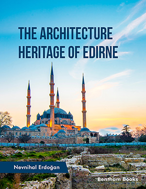
Edirne is a vibrant city of historical importance where civilizations have concentrated throughout the ages, with a unique architectural heritage. Constructions like the Selimiye Mosque from Sinan, the Old Mosque from the fifteenth-century, Üç Şerefeli Mosque, Sultan Beyazid II Mosque, and its many complexes, imarets (public soup kitchens), Dar al-Shifa (medical centers), hans (public inns), baths, bridges, caravanserais, are refined examples of Ottoman-Islamic art. The Architecture Heritage of Edirne is an exploration of the city's architectural Heritage. approaching the past with a historical perspective through works from all the periods it has endured. Starting with the history of Edirne, the book goes into the details of the historical neighborhood, the central district and the historical architecture in the present day city. The book includes notes on the architecture in each notable district and their respective monuments and sites. This is followed by coverage of the architecture of Edirne's former districts. The book concludes with the author's understanding of Edirne's social and economic fabric, both in the past and present. This chapter details the traditional customs, dances, clothing and economic structure of the city. The book is a ley reference for scholars and enthusiasts of urban history, architectural heritage and design, fine arts, humanities and social sciences. The breadth of information covered in the book also makes it a resource for anyone interested in Turkish cultural heritage studies.


